
HomeGlobal CommunityTips & Traps City Guides
Login
Rent a Local Friend © 2026 - All rights reserved.
  • About us
  • RALF Manifesto
  • Our FAQ
  • Terms
  • Privacy
  • Need help? Contact us!
0Local Gurus
0Local Friends
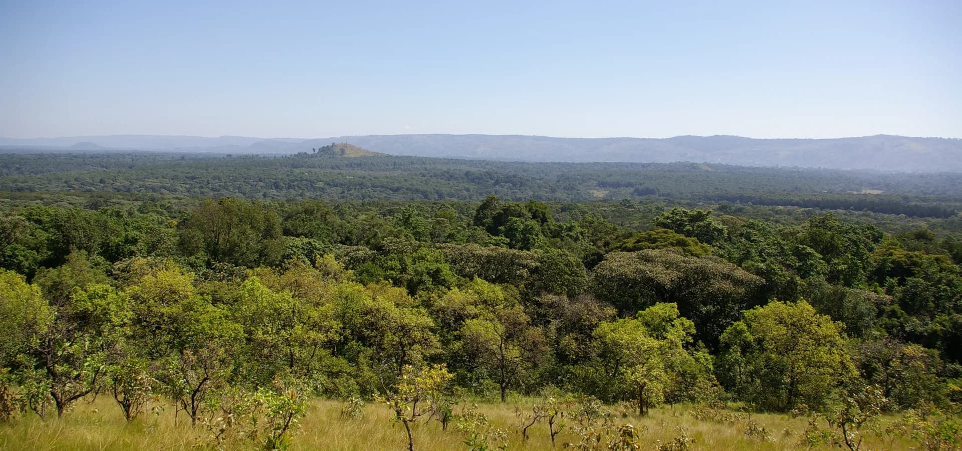
Green canopy of Kakamega Forest stretching to distant hills under a clear sky, seen from Lirhanda Hill

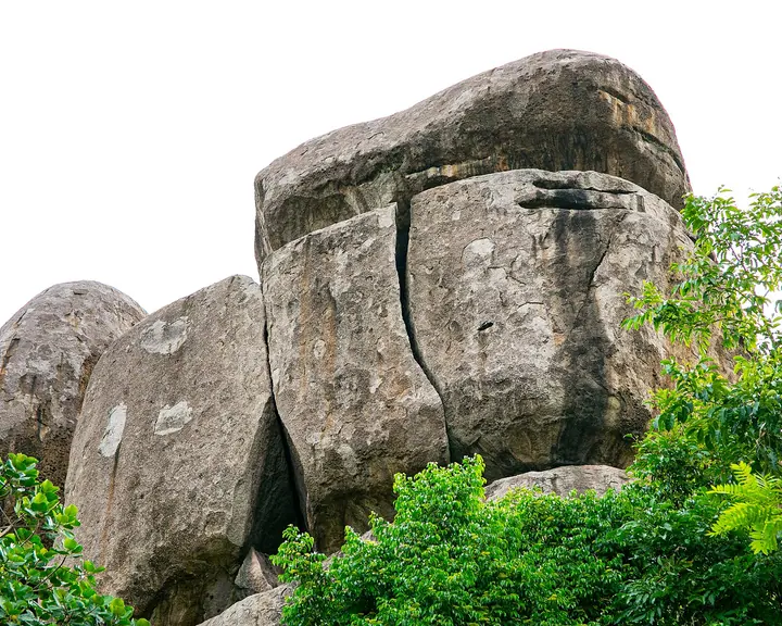
A tall stone on a ridge outside town looks like a figure with a bowed head, and for generations water ran down its face. People call it the Crying Stone of Ilesi, and legend says its tears warned of rain. Lately it cries less often, and locals notice.

A short ride north, Kakamega Forest keeps De Brazza's monkeys and great blue turacos under a dark canopy. On fight days, bulls lock horns at Malinya while Isukuti drums keep the crowd moving. Rain falls in every month, heaviest in April and May, so the forest stays green all year. A Local Friend can find you a seat at a family table where ingokho, the chicken served to honored guests, waits.
Neighborhoods to wander

  • Milimani

    Leafy, well-off residential streets close to the town center.

  • Amalemba

    A busy estate of student flats and family homes off the Mumias road.

  • Isecheno

    Forest-edge area by the Kakamega Forest station, with trails and local guides.

Through the year

  • Malinya bullfighting

    December

    End-of-year bullfights at Malinya grounds, with big crowds and Isukuti drums.

Say it like a local

Mulembe

The Luhya greeting, meaning "peace," usually paired with a firm handshake.

Questions about Kakamega

What travelers ask most before a trip to Kakamega.

  • 1.

    When is the best time to visit Kakamega?

    December to February is the best time, since these are the driest months. Rain falls all year in Kakamega, with the long rains peaking in April and May and a second wet spell around August and September. Mornings in the forest are usually clearer than afternoons, when showers tend to build.

  • 2.

    How many days do you need in Kakamega?

    Two days is enough for most visitors. Spend one day walking the trails of Kakamega Forest for birds and monkeys, and use the second for the Crying Stone of Ilesi and the town itself. Add a day if a bullfight is on at Malinya during your visit.

  • 3.

    How far is Kakamega Forest from Kakamega town?

    The Kakamega Forest National Reserve is about 18 km from town, along the road toward Webuye and Eldoret. The southern part around Isecheno, run by the Kenya Forest Service, is also easy to reach. Both sections have walking trails, and guides can be arranged locally for bird and primate walks.

  • 4.

    What is the Crying Stone of Ilesi?

    It is a rock spire about 40 m tall on a ridge just outside Kakamega, overlooking the Kisumu road. Its Luhya name is Ikhongo Murwi. Water used to run down a groove in its face, and legend links it to a grieving figure. In recent years it has often been dry.

Population
About 107,000Kakamega town urban population, 2019 Kenya census.
Founded
1903British post; gazetted as a township in 1920.
Climate
Tropical rainforestMild and wet all year; long rains in April and May, driest in January.
Last Kenyan rainforest
Kakamega ForestLast Kenyan fragment of the Guineo-Congolian rainforest, 18 km away.
Did you know?
Kenya's biggest sugar millsMumias, West Kenya and Butali factories sit within 40 km of town.
Known as
Heart of Luhya landBig Luhya gatherings are traditionally held at Bukhungu Stadium.
On the street
Luhya, Swahili, EnglishIsukha and Idakho dialects of Luhya are common around town.
Main airport
Kisumu International (KIS)About 50 km south by road; taxis, shuttles and matatus via Kisumu.
Elevation
About 1,560 mHigh enough to keep nights cool, around 14°C, right by the Equator.
Area
About 49 km²Kakamega municipality before its planned expansion, 2019.
Time zone
EAT, UTC+3East Africa Time all year; Kenya does not use daylight saving.
From the capital
About 290 km from NairobiAround 400 km by road, usually 7 to 9 hours by bus.
Born here
Oliver LitondoActor who played Kimani Maruge in the film The First Grader.
Known as
Heart of Luhya landBig Luhya gatherings are traditionally held at Bukhungu Stadium.
On the street
Luhya, Swahili, EnglishIsukha and Idakho dialects of Luhya are common around town.
Main airport
Kisumu International (KIS)About 50 km south by road; taxis, shuttles and matatus via Kisumu.
Elevation
About 1,560 mHigh enough to keep nights cool, around 14°C, right by the Equator.
Area
About 49 km²Kakamega municipality before its planned expansion, 2019.
Time zone
EAT, UTC+3East Africa Time all year; Kenya does not use daylight saving.
From the capital
About 290 km from NairobiAround 400 km by road, usually 7 to 9 hours by bus.
Born here
Oliver LitondoActor who played Kimani Maruge in the film The First Grader.

More cities in Kenya

Beyond Nairobi lie the plains of the Maasai Mara, so keep exploring Kenya with a Local Friend.

  • Nairobi

    2 Local Gurus4 Local Friends
  • Mombasa

    0 Local Gurus0 Local Friends
  • Nakuru

    0 Local Gurus0 Local Friends
  • Kisumu

    0 Local Gurus0 Local Friends
  • Kiambu

    0 Local Gurus0 Local Friends

Nearby cities

  • Bungoma 38 km
  • Kisumu 43 km
  • Ahero 54 km
  • Eldoret 63 km
  • Busia 74 km
  • Kisii 107 km
Explore Kenya
  1. Global Community
  2. /Africa
  3. /Kenya
  4. /Kakamega

Kakamega

Good to know about Kakamega

Practical facts to plan your days, and the stories behind the experiences travelers search for the most.

Last reviewed October 2026

Quick facts

Best time to visit
December to FebruaryThe driest stretch; the long rains usually peak in April and May.
How long to stay
2 daysOne day in Kakamega Forest, another for the Crying Stone and town.
Getting around
Boda bodas and matatusMotorbike and bicycle taxis cover town; matatus run the longer routes.
Taste like a local
Ingokho with ugaliLuhya-style chicken, the dish served to honored guests.
Before you go
Forest entry feeKakamega Forest National Reserve charges park entry, paid to KWS.

Curiosities behind the most-searched experiences

  • Crying Stone of Ilesi

    Locals call it Ikhongo Murwi, a rock spire about 40 m tall shaped like a bowed head. Water once ran down its face and told farmers rain was coming, so a dry stone still makes the news.

    Landmarks & Local History
  • Bullfighting at Malinya

    Bulls are walked into the grounds in loud processions with Isukuti drummers, and a fight ends when one bull turns and runs. Champions earn names like Dragon, and fans earn sore throats.

    Culture & Local Events
  • Kakamega Forest birding

    Around 367 bird species have been recorded here, including the great blue turaco, alongside seven primate species such as the De Brazza's monkey. The turacos, of course, set the schedule.

    Wellness & Nature
  • Kakamega gold rush

    In the 1930s, gold finds around town drew prospectors from abroad and briefly put Kakamega in international headlines. The sugar cane fields that came later proved a steadier fortune.

    Landmarks & Local History
  • Obusuma and the town name

    One story says Kakamega means "to pinch," after the way early European visitors nibbled at obusuma, the local ugali, instead of scooping it the Luhya way. Table manners, now on the map.

    Gastronomy
  • Isukuti drums

    Isukuti is a Luhya dance driven by a set of drums, and it turns up wherever a crowd gathers, from weddings to bullfights. Standing still once the lead drum starts is close to impossible.

    Culture & Local Events
  • Kakamega gold rush

    In the 1930s, gold finds around town drew prospectors from abroad and briefly put Kakamega in international headlines. The sugar cane fields that came later proved a steadier fortune.

    Landmarks & Local History
  • Obusuma and the town name

    One story says Kakamega means "to pinch," after the way early European visitors nibbled at obusuma, the local ugali, instead of scooping it the Luhya way. Table manners, now on the map.

    Gastronomy
  • Isukuti drums

    Isukuti is a Luhya dance driven by a set of drums, and it turns up wherever a crowd gathers, from weddings to bullfights. Standing still once the lead drum starts is close to impossible.

    Culture & Local Events

Tips & Traps in Kakamega

Insider advice from Local Friends in Kakamega: what to do, and what to avoid.

Rainy-season mud: plan your vehicle and shoes
Trap
Getting Around

Rainy-season mud: plan your vehicle and shoes

Kakamega, Kenya
Two forest gates, two operators: check where you pay
Trap
Miscellaneous

Two forest gates, two operators: check where you pay

Kakamega, Kenya
Mama Mutere tree fell in 2014: skip the old listings
Trap
Photography & Views

Mama Mutere tree fell in 2014: skip the old listings

Kakamega, Kenya
Watch potters at work in Ilesi and buy direct
Tip
Shop

Watch potters at work in Ilesi and buy direct

Kakamega, Kenya
Nabongo Cultural Centre: the Wanga kingdom near Mumias
Tip
Art & Culture

Nabongo Cultural Centre: the Wanga kingdom near Mumias

Kakamega, Kenya
Ask the Isecheno guides about a night walk
Tip
Nature & Wellness

Ask the Isecheno guides about a night walk

Kakamega, Kenya
Buyangu Hill: the easy canopy viewpoint
Tip
Photography & Views

Buyangu Hill: the easy canopy viewpoint

Kakamega, Kenya
Hike to Isiukhu Falls with a forest guide
Tip
Sport & Outdoors

Hike to Isiukhu Falls with a forest guide

Kakamega, Kenya
Sleep in a banda or tent at the forest edge
Tip
Sleep

Sleep in a banda or tent at the forest edge

Kakamega, Kenya
Sleep at Rondo Retreat and start walking at first light
Tip
Sleep

Sleep at Rondo Retreat and start walking at first light

Kakamega, Kenya
See all 10 Tips & Traps in Kakamega

Join us Become a Local Friend in Kakamega

There are no Local Friends in Kakamega yet, and that is where you come in.
Earn money showing off your favorite local spots and create unique experiences.
Join our community and be the first to show travelers the Kakamega beyond the postcard.

In the rainy months the tracks around Kakamega Forest turn to slippery mud, and the forest paths are narrow, wet and uneven. A 4x4 helps on the access roads, and cars are not allowed inside the national reserve except on the roads to the Buyangu settlements, so expect to walk…

Kakamega Forest has two main entry points run by different bodies: Buyangu on the north side is KWS, and Isecheno in the south is run by the Kenya Forest Service. Fee lists in older guides disagree with the current KWS page, so use the KWS site for the KWS side and ask at…

Many guides still list the giant Mama Mutere tree as a must-see in Kakamega Forest, but it fell in 2014 after its roots rotted. Only the fallen trunk remains, and the forest officials said locals may visit to pay their respects without disturbing the ecosystem. If you still want…

Isukha and Idakho potters in Ilesi make earthenware by hand, and the centre sits just off the main Kisumu road about six kilometres from town. You can watch them work and buy practical pots or decorative pieces straight from the people who made them. Stop on your way to or from…

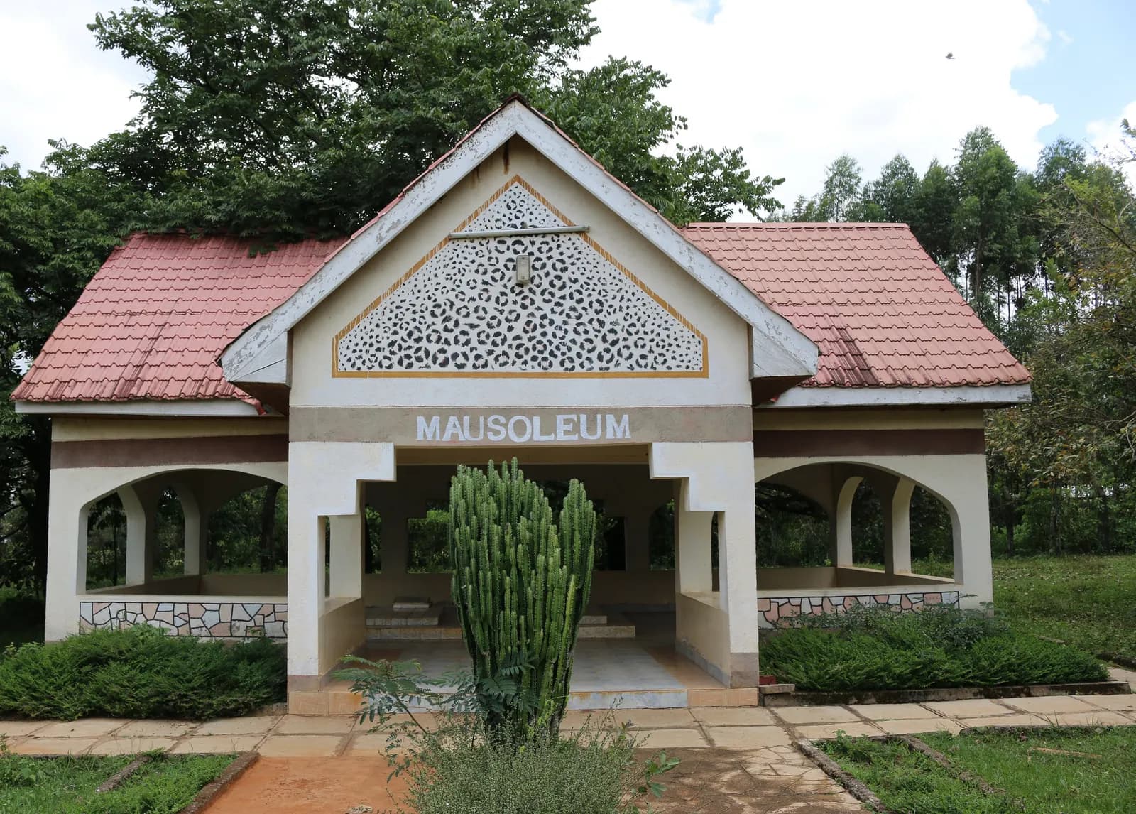
The Nabongo Cultural Centre near Mumias tells the story of the Wanga kings, with a museum of royal regalia, a mausoleum and a traditional Luhya homestead. Mumias is about 37 km from Kakamega, so matatus run there in under an hour, and a boda ride from town takes you the last…

Night walks in Kakamega Forest are listed as a way to meet bats, frogs and night birds, and one visitor account says a night tour would show more of the forest's animals than a day walk. Ask the guides at the Isecheno station to arrange one and agree the route and finish time…

Buyangu Hill is the shorter, easier viewpoint in Kakamega Forest, with a wide view over the rolling treetops. It lies on the northern side of the reserve, the side managed by KWS, and is a gentler alternative to the longer hill hikes. Go early, when the light is soft and the…

Isiukhu Falls drops over rocks into a calm pool deep in Kakamega Forest, and the trail to it is one of the reserve's classic walks. Hire a guide at the Isecheno entrance, who will name the turacos, monkeys and butterflies on the way. The falls run fullest in and just after the…

Isukuti Guest House and Udo's Bandas sit at the edge of Kakamega Forest, with simple hut-style rooms, and Udo and Biota have public campsites. You wake up beside the trails instead of driving 18 km from town, which makes sunrise walks easy. Ask the host about meals and a forest…

Rondo Retreat Centre is one of the few places to sleep right in the Kakamega Forest area, and birders have used it as a base for years. Staying here puts you near the Isecheno trails before the first day trippers arrive from town. Book directly with the centre ahead of your…

Join our community